Overview
Work Package (WP) 9 is a team of national lab scientists who can rapidly plan, collect, and interpret UOW field surveys in novel areas or for underserved communities. This team provides UOWP-CATALOG with much-needed large public data sets early and rapidly to be used in ongoing research. It allows for the testing of early guidelines and workflows in a real-world environment. Lastly, the Field Team affords CATALOG the ability to have a direct and beneficial impact on communities through rapid deployment and educating the public on best practices and value in identifying and characterizing UOWs
Objective
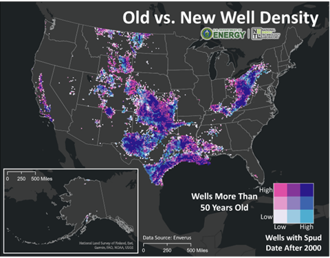
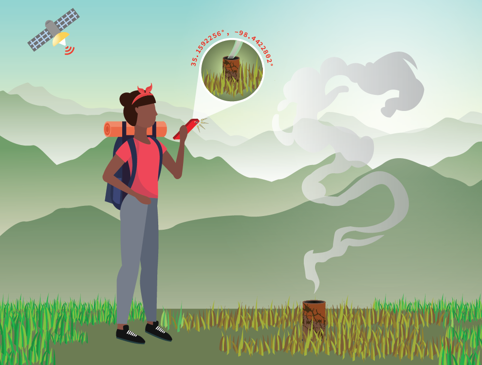
In the first year, the Field Team will execute field campaigns in 3-4 areas with a high need for UOW identification based on their prolific petroleum history and high likelihood of UOW being present. (see map for target areas). For a given area, at least one field campaign will complete UAV geophysical (i.e., magnetics, electromagnetics) and emission concentration surveys, point-source emission quantification, and well characterization.
Short Term Impact:
Quick turnaround on field data is provided to stakeholders for their immediate use. Newly identified UOWs and emission rates allow end users to fill in their well database, prioritize plugging and abandonment efforts, and identify potential environmental risks to their community. Field teams also use these field experiences to inform best practice guidelines and educate communities in the most effective methods for their local area(s).
Long term impact:
These field efforts build a database of real-world geophysical and emissions data that fellow cohorts in CATALOG can take advantage of in their hardware and software work. The effectiveness of field methods in various environments (i.e., flat & forested versus arid & high relief) informs ongoing sensor fusion work. Geophysical data feed into developing machine learning algorithms for testing and validation. Emissions data increases the robustness of existing plume models. Finally, the WP is curating field data from all CATALOG efforts into a database that will eventually be available for public consumption alongside CO2-Locate and CATALOG’s Best Practices.
Accomplishments
The CATALOG Field Team completed a one-week field campaign in Osage Nation (ON), Oklahoma this past October (2023). It is the first of multiple campaigns planned for the ON to identify and locate undocumented oil and gas (O&G) wells, quantify methane and other gas emissions, characterize wellbore integrity, inform prioritization for plugging and/or remediation by ON and Osage Mineral Council (OMC).
Prior to field work, the Office of Fossil Energy and Carbon Management (FECM) and the ON executed an MOU as a framework for collaboration between the two entities (“Parties”) to ensure that any R&D and workforce training and development investments and efforts are conducted in a strategic, coordinated, efficient, and equitable manner. Through this MOU, FECM and ON will collaborate to build capacity, provide needed technical assistance, share data on undocumented orphan wells for the direct benefit of the Osage Nation and their people. The enhanced coordination and collaboration between the Parties is intended to maximize the benefit of both public and private investment in the development of an equitable energy future for the Osage Nation. Activities include searching for undocumented orphan wells using historical and field-based methodologies, including historical record searches, ariel drone surveys, and on-ground measurements; sharing all collected data and resulting interpretation; and supporting the development of the Osage Nation’s own undocumented orphan well identification capabilities.
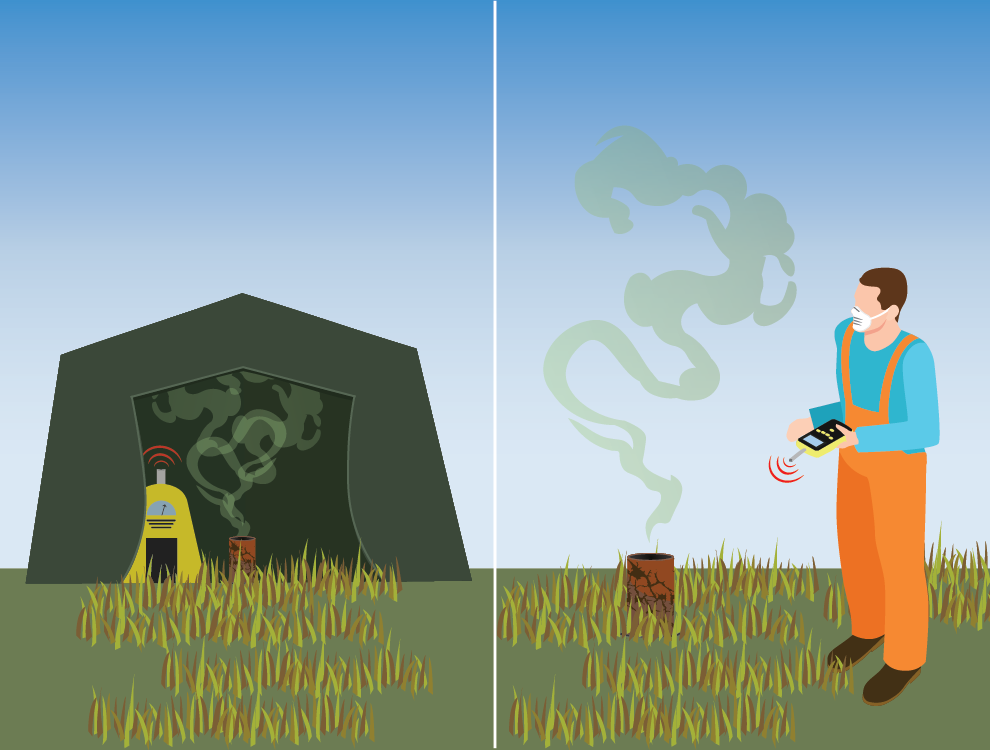
The Team conducted multi-sensor Unmanned Aerial Vehicle (UAV) surveys over areas that the ON and OMC identified as high priority areas of interest— Osage Nation Ranch and Lost Creek Ranch. Key drivers in their prioritization are possible data gaps in the Bureau of Indian Affairs (BIA) O&G well database based on incomplete well records and knowledge of local history. Airborne surveys have two objectives: detect wells, which can later be contrasted against the Bureau of Indian Affairs (BIA) O&G well database to identified undocumented wells and detect anomalous methane levels relative to background levels which may be indicative of leaky wells.
Airborne surveys were successful in locating wells close to the map with a slight offset attributed to coordinate inaccuracies in well records. Wells are easily identifiable in the resulting magnetic anomaly maps as bullseye-shaped features with moderate to strong magnetic field responses. Several methane “hot spots” are observed in the airborne methane sensor data and corroborated with ground measurements. The magnetic survey yielded 30 anomalies which correspond to 27-28 documented wells assuming some position error in the BIA’s database. Of those detected wells, 12 were sampled and three found to be emitting methane (8, 50, and 800 g/hr).
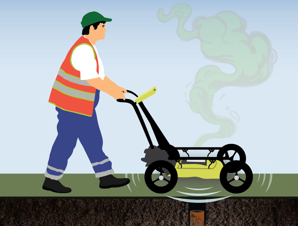
The Team also conducted a methane quantification survey on the ground. Previous machine learning work already identified potentially undocumented wells from historic topographic maps. This location data guides the team’s ground efforts and, in turn, provides essential ground confirmation to machine learning efforts. Small ground magnetometer surveys located the well at these locations. A combination of high-resolution methane concentration and flow rate measurements and emission imaging provide a robust characterization of leaking wells. The ground team samples 10 wells and found two to be emitting methane: one bubbling at 2 g/hr and another at 1 g/hr.
The team’s first field campaign in Osage Nation resulted in 2-3 UWs, quantified emissions from an active well (42 g/hr, >1000 ppm) and a large pipeline, and five leaking wells with a mean emission rate of 40 grams per hour and 22% measurable leak. Leaking is a particular issue for old wells with old infrastructure and small well operators. Magnetic anomaly data will be contoured and delivered in geospatial data formats and maps to Osage Nation. Methane data (airborne and ground based) require incorporating wind data for further analysis and interpretations. Together, magnetic, methane and wind data offer us an integrated approach in locating O&G wells and quantifying emissions.
Research Products
TBD

Target field areas for WP9. Field work in Osage Nation is currently in progress.

Field areas of interested surveyed or targeted by CATALOG and WP9.
Contacts
Christine Downs
Sandia National Laboratories
cdowns@sandia.gov